

Storm clouds over Highway 50 (Photos (c) Bonnie J. Schupp)

Crossing Nevada on
the “loneliest road”
amid some stormy weather
Downpour presents a free car wash.
Some folks would likely prefer taking the high road west
from Utah, but Interstate 80 would have meant back-tracking – and besides, the
low road seemed to offer the unpredictability we enjoy. So we left Spanish Fork
heading for U.S. Highways 6 and 50, starting out with sunshine and fluffs of
beautiful white clouds.
 |
| Not the other Sinclair, alas. Maybe someday. |
We soon found an old, deserted pumpless Sinclair gas station,
that was more like a big locked garage with the brand name above the door in
large-letter faded paint. It was a perfect setting for a photo, and a young
Mormon couple were already there with camera and tripod trying our angles and
poses (and a couple of kisses). They were from Salt Lake City, enjoying a
Sunday drive.
Then another couple stopped to admire and photograph the
structure… and they were from Munich, Germany.
Finally, Bonnie and I had our turn, and I posed wearing my new
white cowboy hat – the gift from Brian Rutledge that served me so well during
the rodeo. I lowered my head for artistic
purposes, and Bonnie took several pictures.
Then we continued west as the clouds slowly darkened.
Nearing the Utah-Nevada border, we noticed what appeared to be a huge lake south
of the highway. But the closer the road and “water” converged, it became clear
this was an illusion. It was a former body of water gone dry, labeled on our map
as “Sevier Lake Dry.”
 |
| Sevier "lake" before the storm |
We walked across the “beach” on the edge of the “lake,” which
had a few tire tracks indicating some folks have a strange sense of
invulnerability. I can just imagine getting stuck in the middle! As we walked
back to our trusty Toyota Camry, there were distant booms and flashes of lightning…
time to get across the border.
Continuing westward through sporadic downpours, and having
not seen much in the way of accommodations, we decided to stop in the old
mining town of Ely (pronounced EEE-Lee). It had a grocery store, gas stations,
interesting artsy shops, several casinos and bars, and the historic Hotel
Nevada, which had a bar, casino and Denny’s restaurant downstairs.
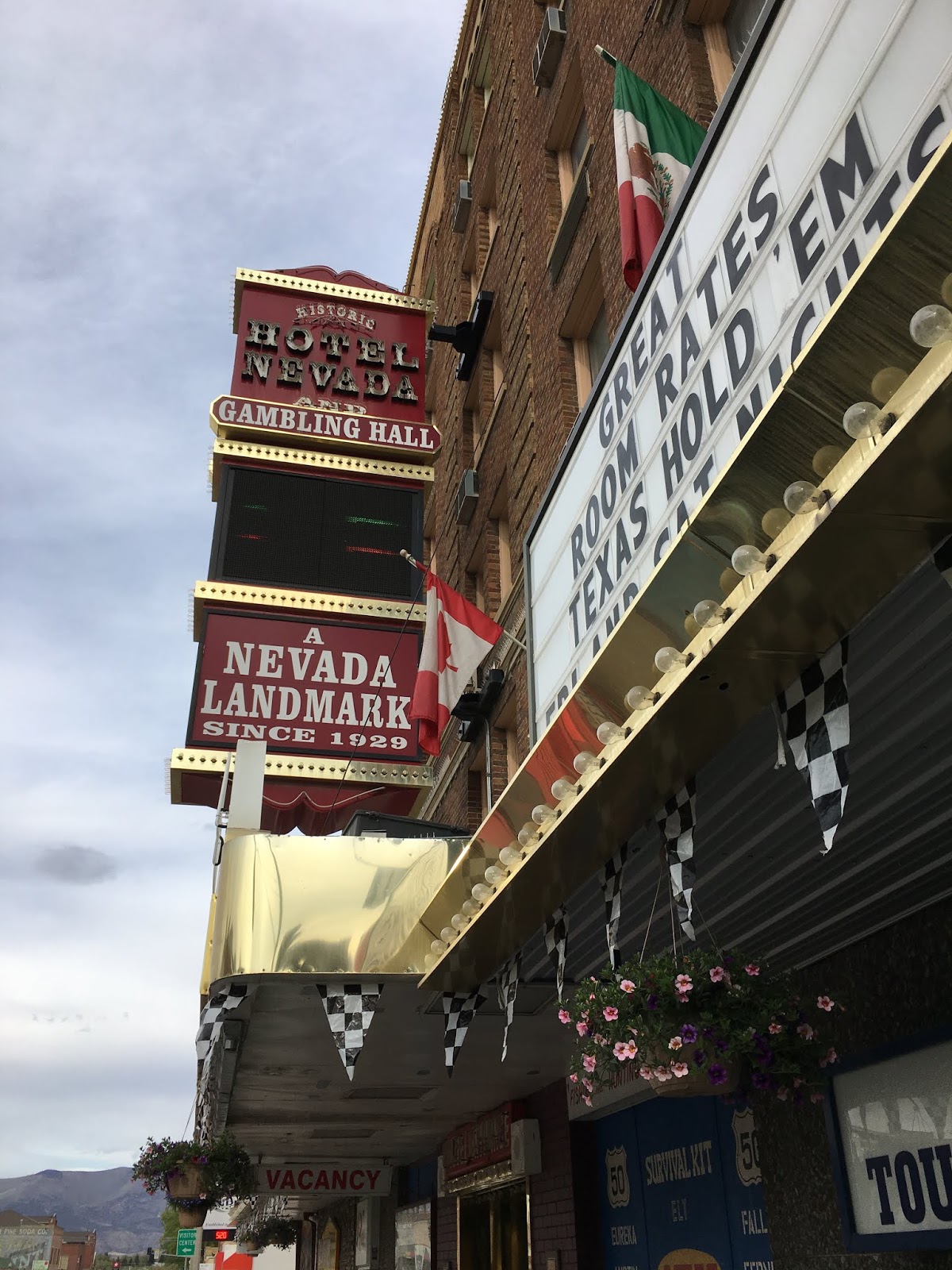 |
| Hotel Nevada |
The floors had small, but relatively nice rooms (king bed in ours) and tiny bathrooms with a
warning that given the age of the building (it opened in 1929), hot water might
be erratic. Mints on the dresser, even. The cost of just under $80 included coupons
for free breakfasts and two margaritas. There was a parking lot out back, but I
found a space by the curb nearly at the hotel entrance.
We really lucked into getting the king room, because all of
them had been booked and the nice desk clerk gambled there would be a few
no-show cancellations. It was “race day” in the area, a twice-a-year event in
which amateur drivers test their high-speed mettle on a 60-mile stretch of highway
that police close for a day. They compete in various speed categories, in cars
ranging from antique sportscars to one parked by the side of the hotel – a stunningly
restored Corvette. Top speeds in the 120-mile down-and-back race reportedly
reached 165 mph.
The Nevada has a walk of fame along the sidewalk, with
Hollywood-style stars bearing the names of such guests as Gary Cooper, Ingrid
Bergman, Jimmy Stewart and even Lyndon Johnson. (I’m guessing they stayed in
the pricier suites.)
I spent an hour in the casino, trying various machines, and
ended up – after hitting a straight in poker – losing only two bucks.
At an antique store a few blocks from the hotel, I learned about the promotion of Nevada's stretch of Highway 50 as "the loneliest road in America.”
According to a Wikipedia entry, the name was bestowed by Life magazine in 1986 as a pejorative for its long desolate
stretches, but was seized upon as a marketing tool instead. There’s even a U.S.
50 “survival kit” distributed by merchants, but the places we looked for them
had all run out. Evidently, it features places to stop, and shop or see, and provides
for getting the booklet stamped at each.
 |
| Eureka's welcome sign |
And it was pretty desolate as we drove across several
mountain passes. One town where we stopped, Eureka, Nevada, had seen better days
in its mining era, but local folks were fixing up some storefronts and hoping
for a business boom in tourism. There’s a museum, an old opera house and old hotel
building, and a welcoming sign billing Eureka as “the friendliest town on the
loneliest road in America.”
Near Hickison Summit (elev. 6,591 feet), we stopped to check
out a petroglyph site, but the ancient markings on walls of the slope were very
faint. Easier to find on our six-tenths of a mile walk was a modernist
petroglyph with a peace symbol and the words “Give Peace a Chance.”
 |
| Me, at petrogyyph site summit |
We stopped for lunch further along the way at the
even-smaller town of Austin, enjoying an excellent grilled ham and cheese at a café
on the main street, and that’s when the storm caught up with us. Torrential
rain, pea-size hail, an epic downpour soaked the town and sent water rushing on
the edge of road. As the storm slowed to a drizzle, we climbed over the little rain
river and into our newly-washed car.
Two hours later, we checked into a Holiday Inn Express in
the larger town of Fallon, some 60 miles east of Reno, setting us up for a
quick drive north back to Interstate 80 and the push into California.
Next Chapter: Left Coast downy ocean


No comments:
Post a Comment